Physical Address
304 North Cardinal St.
Dorchester Center, MA 02124
Physical Address
304 North Cardinal St.
Dorchester Center, MA 02124

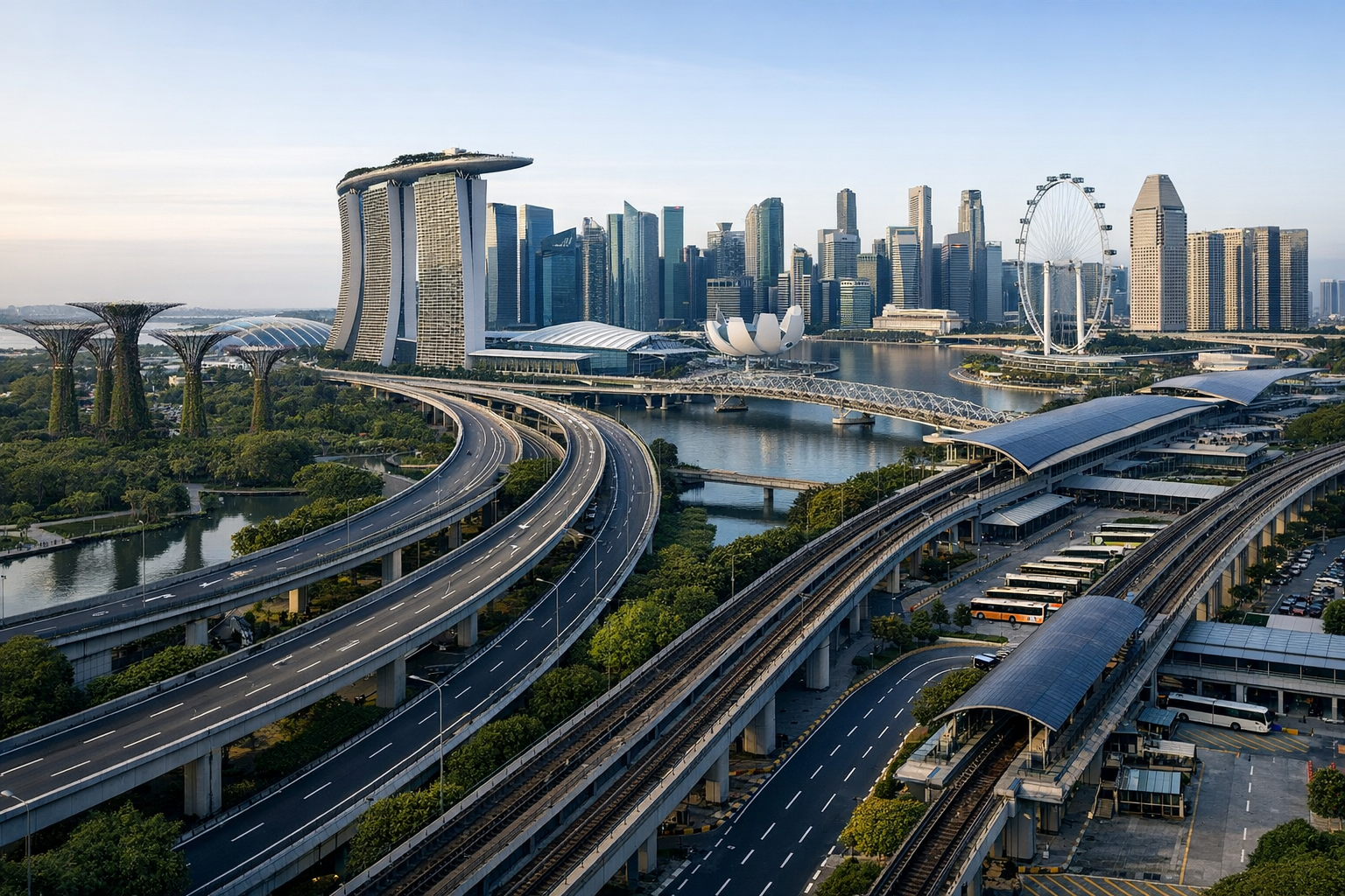
Singapore is outperforming many Western cities on urban efficiency because it plans housing, transport, utilities, and land use as one system instead of treating them as separate political fights. Singapore’s resident population reached 4.2045 million in 2025, and the city-state serves that population through a planning structure that links land allocation, public housing, transport capacity, and water resilience inside one national framework. The result shows up in everyday urban systems: most households live in public housing, rail and bus expansion is planned against strict land limits, and water supply is managed as a long-range resilience programme rather than a last-minute emergency fix.
Singapore’s edge is institutional, not just dense. The Urban Redevelopment Authority (URA), Housing and Development Board (HDB), Land Transport Authority (LTA), and Public Utilities Board (PUB) operate through linked planning horizons, including a Long-Term Plan looking 50 years and beyond, a statutory Master Plan reviewed every five years, and agency-level delivery programmes that flow from that structure. That coordination means housing, transport, and utilities are decided together, not in sequence. Singapore does not necessarily win because it builds everything faster. It wins because it coordinates more of the city before projects start colliding with one another.
Where many Western metropolitan systems split authority across municipalities, transit agencies, utility bodies, and higher levels of government, Singapore concentrates more decisions inside one statutory planning stack. URA sets the land-use framework, HDB provides the dominant housing platform, LTA expands rail, bus, and cycling networks within strict land constraints, and PUB plans water resilience as part of national infrastructure. That does not mean Singapore has no trade-offs. It means the trade-offs are identified earlier and managed inside one system.
The immediate policy trigger is the latest planning cycle. In July 2025, URA published the Draft Master Plan 2025, framed around integrated liveability, resilience, growth, and nature stewardship. The plan sits inside a planning stack that joins the long-range Long-Term Plan to the statutory Master Plan. That procedural rhythm lets Singapore update land allocations, development intensity, housing form, and growth nodes without reopening the whole system from scratch each time.
This matters because urban inefficiency often comes from sequencing failures rather than lack of ambition. A housing expansion arrives without enough rail capacity. A rail scheme is approved without enough nearby housing or jobs. Utility upgrades become late-stage obstacles instead of early design inputs. Singapore’s current planning cycle is built to reduce those collisions.
The practical advantage is not speed in the abstract. It is fewer institutional bottlenecks. When a city splits authority across local councils, regional transport operators, utility districts, and national ministries, each body can delay the others. A housing project may clear planning but lack transport capacity. A rail scheme may be approved without enough nearby housing to support ridership. Water and power upgrades can become late-stage obstacles rather than early inputs.
Singapore narrows that gap by design. The Draft Master Plan 2025 explicitly linked liveability, resilience, growth, and nature stewardship, and it included policy tools such as Community Care Apartments, which require coordination across multiple ministries and agencies. Decisions about ageing, housing form, and land use are made in one process rather than pushed through disconnected departments. That is a structural reason the city performs well on implementation.
URA’s role is stronger than the planning departments found in many Western city governments. The Master Plan is statutory and sets permitted land use and development intensity for the next 10 to 15 years, with a mandatory review every five years. That gives Singapore a formal reset point, letting it absorb population change, ageing, new industries, and transport investment without relying on piecemeal rezonings as the main tool.
In more fragmented metropolitan systems, local councils or boroughs can shape land use in ways that conflict with regional transport or national housing goals. Singapore’s statutory authority and coordinated agency mandates reduce that friction by design. That does not eliminate politics, but it does shrink the number of veto points.
Housing is where the governance advantage becomes hardest to ignore. 77.4% of resident households lived in HDB flats in 2024, according to SingStat, and 90.8% of resident households were owner-occupied in the same year. HDB and the Ministry of National Development also describe HDB flats as home to close to or over 80% of Singapore’s resident population. Those figures use different denominators, households in one case and people in the other, but they point in the same direction: public housing is the dominant urban platform, not a residual safety-net sector.
This scale matters because housing policy is not marginal to urban planning when most households live inside one public system. That system’s location, density, and transport connections shape the entire city. HDB developments are built with transit access, local amenities, and service provision planned as integrated packages rather than as afterthoughts. In many Western cities, public housing is too small or too fragmented to play that role.
LTA’s published network figures show how land scarcity shapes transport policy. The road system occupies about 12% of Singapore’s land area, with more than 9,500 lane-km of roads and expressways, but the strategic growth bet is still on public transport, not unlimited road expansion. Singapore had a 285 km rail network in the 2023/24 reporting period and plans to expand it to about 360 km by the 2030s. It also ran more than 6,100 buses on 360 routes.
The city is working toward a 75% mass public transport peak-period mode share by 2030, and it is expanding cycling paths from more than 600 km to around 1,300 km by 2030. Those targets show the transport system is still being rebalanced around land scarcity, not managed as a finished product. The key point is not that Singapore has solved transport forever. It is that the system still evolves inside one land-constrained strategy.
The cleanest comparison is not a league table. It is institutional structure. OECD work published in 2024 showed that public transport quality varies widely across urban areas and that service in commuting zones often lags well behind core city centres. Singapore’s advantage starts before ridership. It plans housing and employment around a national land-use framework, then funds transport to fit that framework. Many Western metros do the reverse, trying to retrofit mobility into dispersed development patterns created by fragmented land decisions.
That is why Singapore often looks unusually efficient from the outside. The city-state is not just denser or more technocratic. It is making fewer contradictory promises at the same time. Western cities often try to lower housing pressure, improve transit, protect neighbourhood character, preserve parking, and expand infrastructure while splitting authority across many elected bodies and agencies. Singapore bundles more of those decisions together upfront. In simple terms, many Western cities do not lack plans. They lack alignment.
Residents in HDB towns are the most direct beneficiaries. They receive housing inside a system that is also planning transport access, local amenities, and service provision. The geographic scope is national, but the effect is neighbourhood-scale in mature and newer HDB towns where daily life depends on predictable links between homes, transit nodes, and public facilities.
Older residents are a distinct group. URA’s 2025 planning framework highlighted housing forms such as Community Care Apartments, which tie ageing policy to land use rather than leaving elder care as a separate welfare file. Commuters and employers also gain from a system that is trying to decentralise jobs and connect them through rail and bus networks instead of forcing every trip through one central core.
Utility users benefit in a quieter but equally material way. PUB’s water strategy combines NEWater, local catchment, imported water, and desalination, with NEWater’s origins traced back to feasibility work in the 1970s. Households, industry, and public facilities are less exposed to single-point supply stress than cities that still treat water reuse as a pilot project rather than core infrastructure.
Singapore’s efficiency does not come from a lack of constraints. It comes from choosing them early and making them governable. Land scarcity is the obvious one. Water security is another. PUB’s December 2025 decision to study a new desalination plant, using a compact multi-storey design to reduce land footprint, shows how even utility expansion is shaped by spatial discipline. The state is not solving one problem at a time. It is trying to solve supply, resilience, and land efficiency in the same project brief.
Singapore already had five desalination plants in operation by December 2025, and PUB’s feasibility work points to added capacity if demand and resilience needs justify it. Plans are reviewed on a fixed cycle. Agencies are reset against new data. Land is reallocated with a statutory clock. That routine is what keeps the system aligned.
The fairest answer is that Singapore’s lead is real, but the comparison is not perfectly symmetrical. Singapore is a city-state, not a metropolitan area divided across competing municipalities. It has unusual control over land, infrastructure, and long-range planning. That gives it structural advantages many Western cities do not have.
But that does not make the comparison useless. It makes the lesson more specific. The strongest claim is not that every Western city should copy Singapore’s politics, geography, or housing model. The stronger claim is that Singapore is outperforming many Western cities because it treats governance itself as core infrastructure. It aligns land, housing, transport, and utilities earlier, with fewer institutional collisions, and that advantage shows up in daily urban life.
The next milestones are already visible in transport and water policy. LTA is working toward a rail network of about 360 km by the 2030s, up from 285 km in the current system, and it is expanding cycling paths from more than 600 km to around 1,300 km by 2030. The transport system is still being rebalanced around land scarcity, not managed as a finished product.
Water policy is also still in build mode. Singapore already had five desalination plants by late 2025, and PUB’s feasibility work points to added capacity if demand and resilience needs justify it. City governments looking for a lesson should focus less on iconic projects and more on the governance routine that keeps systems aligned year after year.
The reason this argument has traction now is that many Western cities are struggling with the same trio of pressures at once: housing shortages, transit under-capacity, and climate-resilience demands. In those systems, each problem is often assigned to a different institution, budget, or election cycle. Singapore looks efficient partly because it is reducing those handoff failures.
The local context also matters. Singapore is not competing against sprawling federal systems on cheap land or unlimited road capacity. It is working under severe spatial limits. That makes its planning discipline easier to see. When roads already consume about 12% of national land area, every housing, rail, cycling, and water decision becomes a land-efficiency decision too. That is what gives the case value beyond Singapore itself.
Does Singapore have a single official ranking for urban efficiency?
No. The case rests on component systems rather than one official ranking. The strongest evidence is in land-use coordination, housing delivery scale, transport planning, and water resilience.
Are the HDB housing figures contradictory?
No. 77.4% refers to resident households living in HDB flats in 2024, while close to or over 80% refers to the resident population. One is a household measure and the other is a people measure.
Why compare Singapore to Western cities at all?
The comparison is useful because many Western metropolitan systems divide authority across local governments and agencies. Singapore concentrates more authority in a national statutory framework, which changes how quickly land, housing, transport, and utilities can be aligned.
Is Singapore’s model only about density?
No. Density helps, but the main point is institutional coordination. Dense cities can still perform poorly if housing, transport, and utilities are planned through separate bodies with conflicting priorities.
Can other cities copy Singapore directly?
Not fully. Singapore is a city-state with unusual control over land and infrastructure. The more transferable lesson is procedural: align agencies, review plans on a fixed cycle, and make land-use decisions early enough to shape transport and utilities before projects stall.
So what is the real lesson here?
Singapore is outperforming many Western cities on urban efficiency because it treats governance as infrastructure. That is a harder advantage to replicate than any single rail line or housing programme, but it is also the part most worth studying.